


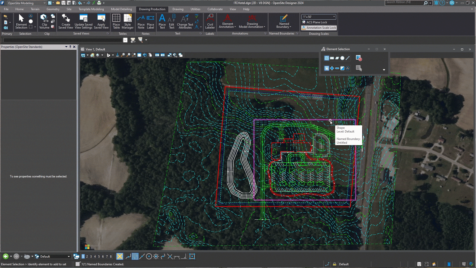
- Plan Production
-

10X Faster Construction Drawings
Cut production time, reduce errors, and ensure consistency across all project documentation with AI-assisted drawing production. Benefit from:
- Automated annotations, labeling, and sheeting
- Dynamic change management for instant updates
- Customizable standards and client requirements enforcement
- Copilot
-
Reduce Time Spent on Manual Data Retrieval and Analysis
Use natural language or voice-activated commands to ask questions and execute tasks (parking count, building square footage, confirm zoning), receiving evidence-based answers from your existing site designs and project documentation. Benefit from:
- Instant suggestions to complex problems
- Real-time design optimization
- Client requirement and compliance checks
- Voice-activated design creation and modification
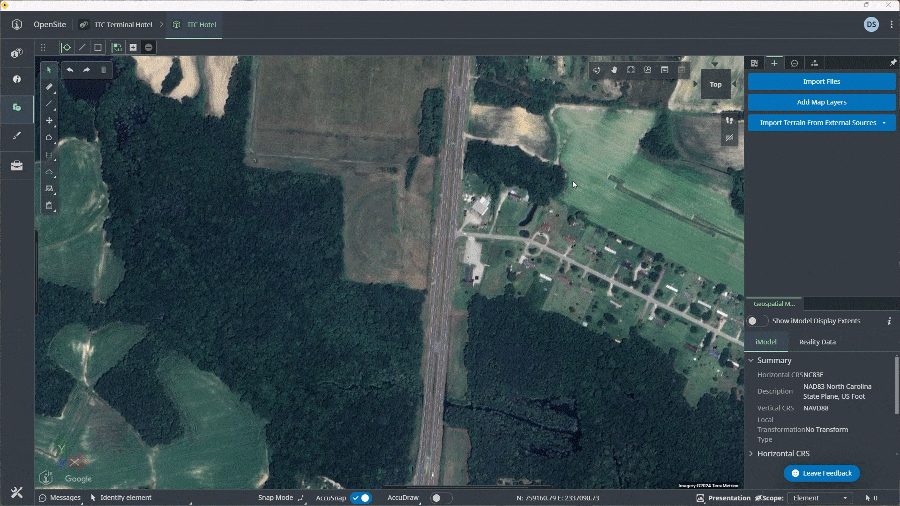
- Data Acquisition
-

Instantly Access and Integrate Contextual Data
Consolidate diverse data formats into a project-ready foundation to quickly start projects with accuracy. Integrate contextual information from multiple high-quality sources, including:
- World Terrain (Cesium tiles)
- USGS terrain data
- Integrated image streaming services
- GIS (ESRI) platforms
- File-based terrain (GeoTIFF, LandXML)
- CAD files (DGN, DWG)
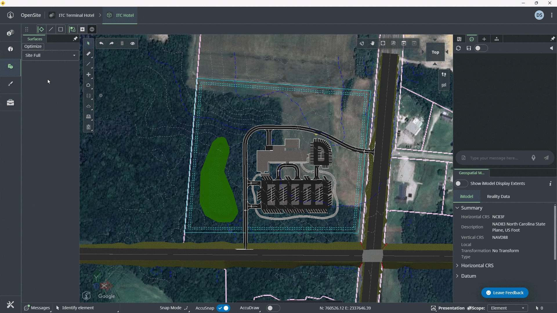
- Earthworks
-
Optimal Construction Costs in Minutes
Minimize delays and cost overruns caused by unforeseen site conditions with data-driven decision-making. Enhance your estimating process with:
- Thousands of design scenarios evaluated with a click of a button
- Precise cut/fill analysis for best-value construction
- Real-time cost updates with design changes
- Dynamic grading adjustments for parking lots, roads, buildings and more
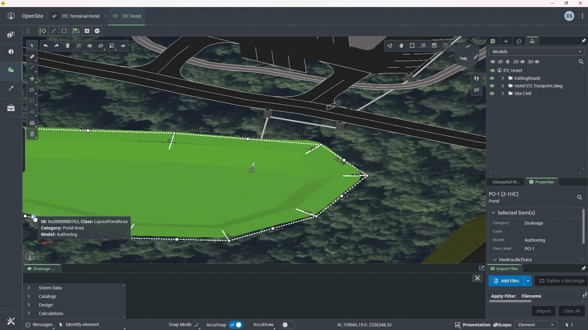
- Drainage
-
Integrated Drainage Design and Analysis
Simplify stormwater design with native OpenFlows design and analysis capabilities. Benefit from:
- Seamless design-analyze-optimize workflows
- Accuracy in drainage calculations
- Reduced risk of data loss
- A time-saving unified platform
10X Faster Construction Drawings
Cut production time, reduce errors, and ensure consistency across all project documentation with AI-assisted drawing production. Benefit from:
- Automated annotations, labeling, and sheeting
- Dynamic change management for instant updates
- Customizable standards and client requirements enforcement

Reduce Time Spent on Manual Data Retrieval and Analysis
Use natural language or voice-activated commands to ask questions and execute tasks (parking count, building square footage, confirm zoning), receiving evidence-based answers from your existing site designs and project documentation. Benefit from:
- Instant suggestions to complex problems
- Real-time design optimization
- Client requirement and compliance checks
- Voice-activated design creation and modification
Instantly Access and Integrate Contextual Data
Consolidate diverse data formats into a project-ready foundation to quickly start projects with accuracy. Integrate contextual information from multiple high-quality sources, including:
- World Terrain (Cesium tiles)
- USGS terrain data
- Integrated image streaming services
- GIS (ESRI) platforms
- File-based terrain (GeoTIFF, LandXML)
- CAD files (DGN, DWG)
Optimal Construction Costs in Minutes
Minimize delays and cost overruns caused by unforeseen site conditions with data-driven decision-making. Enhance your estimating process with:
- Thousands of design scenarios evaluated with a click of a button
- Precise cut/fill analysis for best-value construction
- Real-time cost updates with design changes
- Dynamic grading adjustments for parking lots, roads, buildings and more
Integrated Drainage Design and Analysis
Simplify stormwater design with native OpenFlows design and analysis capabilities. Benefit from:
- Seamless design-analyze-optimize workflows
- Accuracy in drainage calculations
- Reduced risk of data loss
- A time-saving unified platform