Unlocking Papua’s Access through Data-Driven Geotechnics
SUSTAINABILITY CHALLENGE
One of the 4 Key Sustainability Challenges
Story Highlights
UTILIZED SOFTWARE
Bentley Software
LOCATION
ORGANIZATION/COMPANY
PROJECT SUMMARY
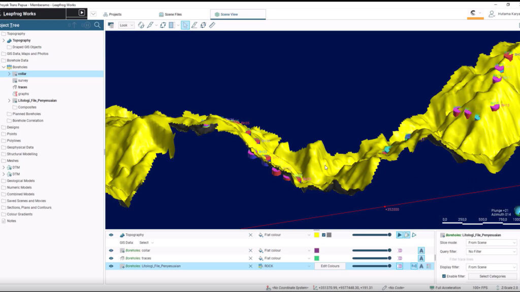
PT Hutama Karya is constructing the 50.14 km Mamberamo–Elelim Section of the Trans Papua Road (with an investment value of USD 209 million), creating a critical lifeline through the region’s remote, mountainous highlands. To conquer the extreme terrain, 75m deep excavations, and scarce geotechnical data, the team adopted a comprehensive digital strategy integrating Bentley solutions. The process began with LiDAR and ContextCapture for precise 3D terrain models, followed by Leapfrog, which generated detailed 3D geological models. These models were then input into GeoStudio and PLAXIS 2D to analyze slope stability and deep-cut reinforcement strategies. This digital approach yielded significant returns: it mitigated failure risks valued at USD 2.5 million, optimized costs by USD 1 Million, and saved 640 engineering work hours. Furthermore, the project was accelerated by two months, and it reduced CO2 emissions by 49,672 kg. Most importantly, the road dramatically cuts travel time from 6 hours to 1 hour 20 minutes, providing safe, reliable access for over 1.45 million people, fostering Healthy Cities & Communities and enhancing regional development.
Relevant UN Sustainable Development Goals (SDGs)
SDG Goal 1
No Poverty
End poverty in all its forms everywhere.
SDG Goal 2
Zero Hunger
End hunger, achieve food security and improved nutrition and promote sustainable agriculture.
SDG Goal 3
Good Health and Well-Being
Ensure healthy lives and promote well-being for all at all ages.
SDG Goal 4
Quality Education
Ensure inclusive and equitable quality education and promote lifelong learning opportunities for all.
SDG Goal 5
Gender Equality
Achieve gender equality and empower all women and girls.
SDG Goal 6
Clean Water and Sanitation
Ensure availability and sustainable management of water and sanitation for all.
SDG Goal 7
Affordable and Clean Energy
Ensure access to affordable, reliable, sustainable and modern energy for all.
SDG Goal 8
Decent Work and Economic Growth
Promote inclusive and sustainable economic growth, full employment, & decent work for all.
SDG Goal 9
Industry, Innovation and Infrastructure
Build resilient infrastructure, promote inclusive and sustainable industrialization & foster innovation.
SDG Goal 10
Reduced Inequalities
Reduce inequality within and among countries.
SDG Goal 11
Sustainable Cities and Communities
Make cities and human settlements inclusive, safe, resilient and sustainable.
SDG Goal 12
Responsible Consumption and Production
Ensure sustainable consumption and production patterns.
SDG Goal 13
Climate Action
Take urgent action to combat climate change and its impacts.
SDG Goal 14
Life Below Water
Conserve and sustainably use the oceans, seas and marine resources for sustainable development.
SDG Goal 15
Life on Land
Sustainably manage ecosystems, combat desertification, reverse land degradation, & halt biodiversity loss.
SDG Goal 16
Peace, Justice and Strong Institutions
Foster peaceful & inclusive societies, ensure justice access, & build effective, accountable institutions at all levels.
SDG Goal 17
Partnerships for the Goals
Strengthen the means of implementation & revitalize the Global Partnership for Sustainable Development.
