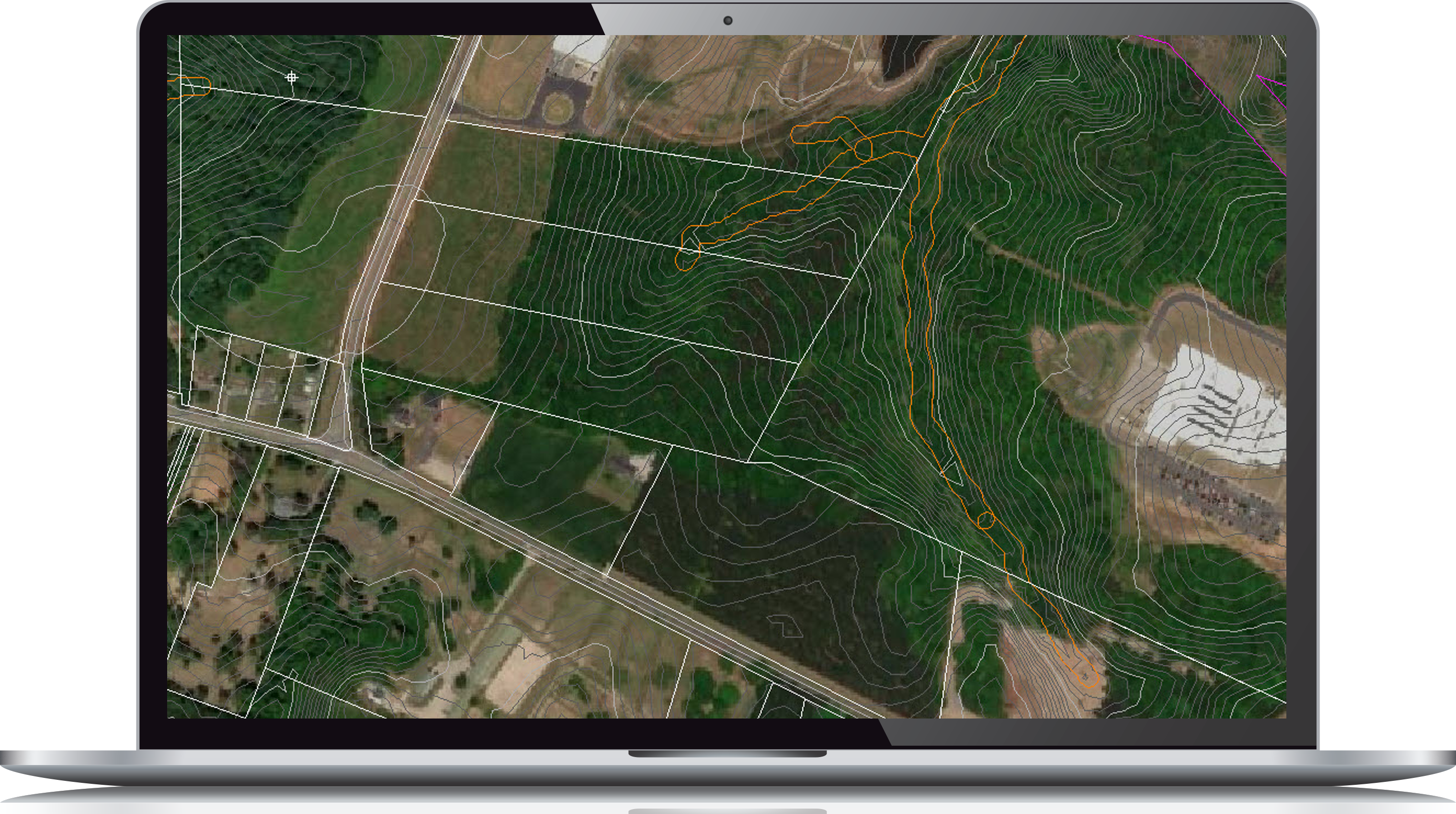
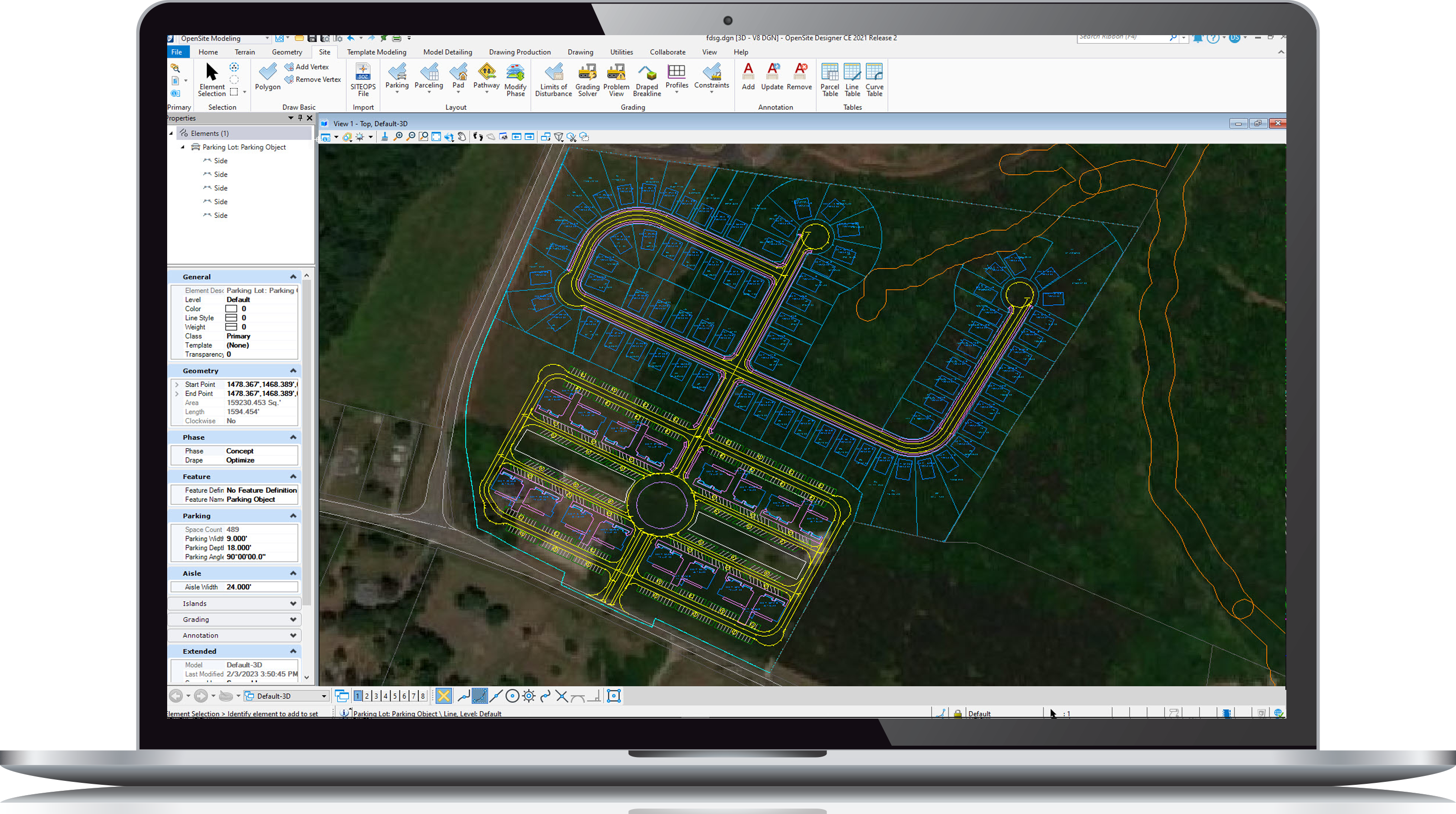
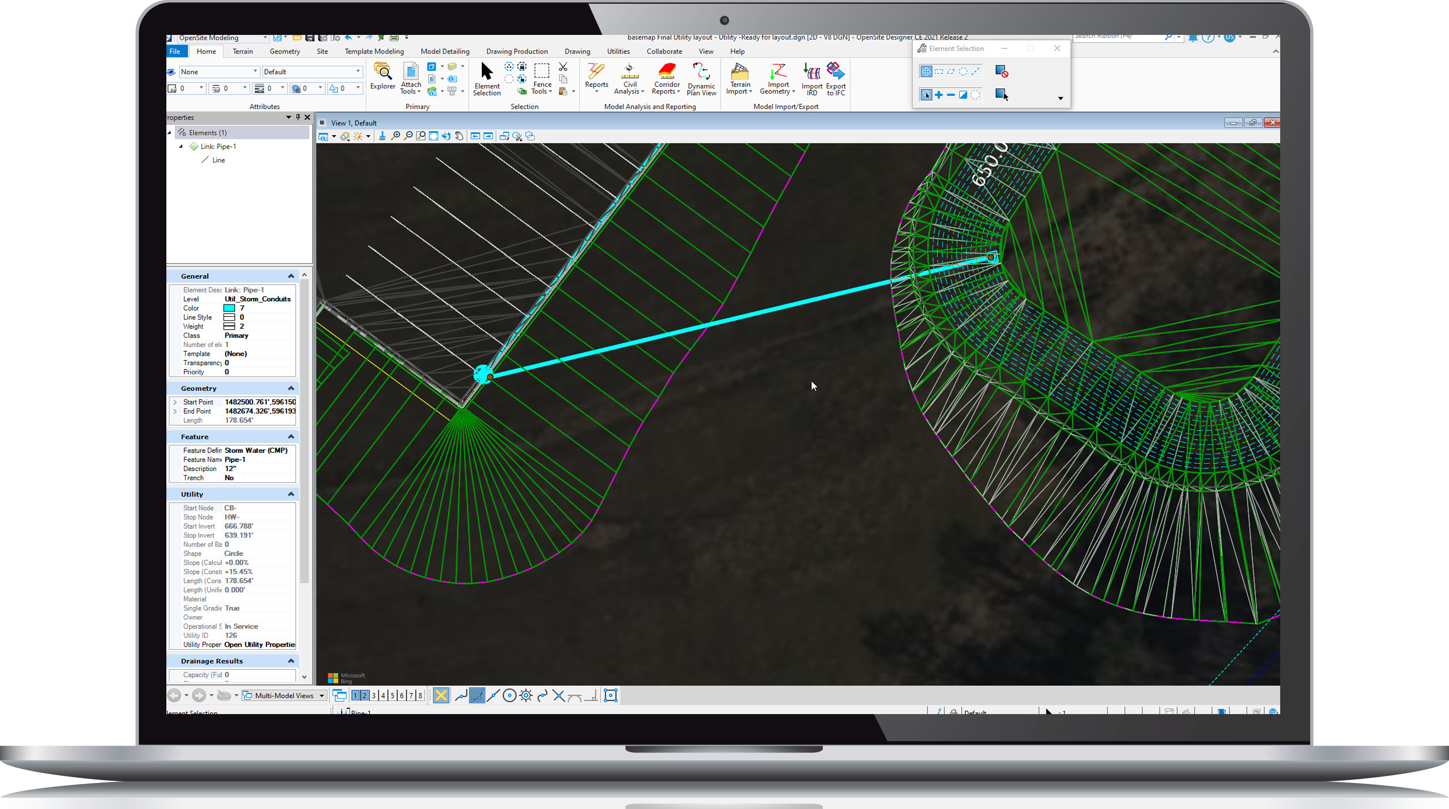
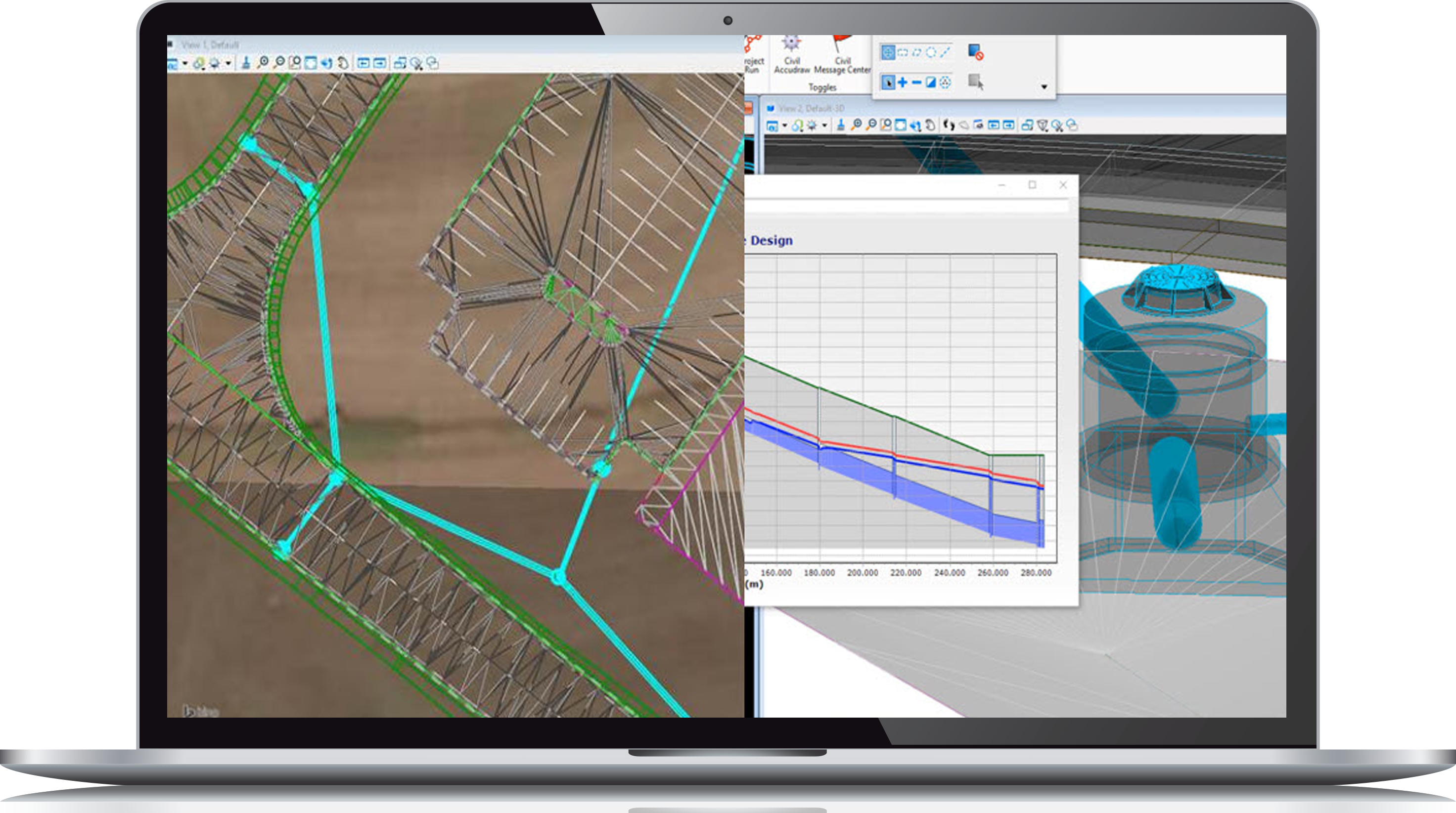
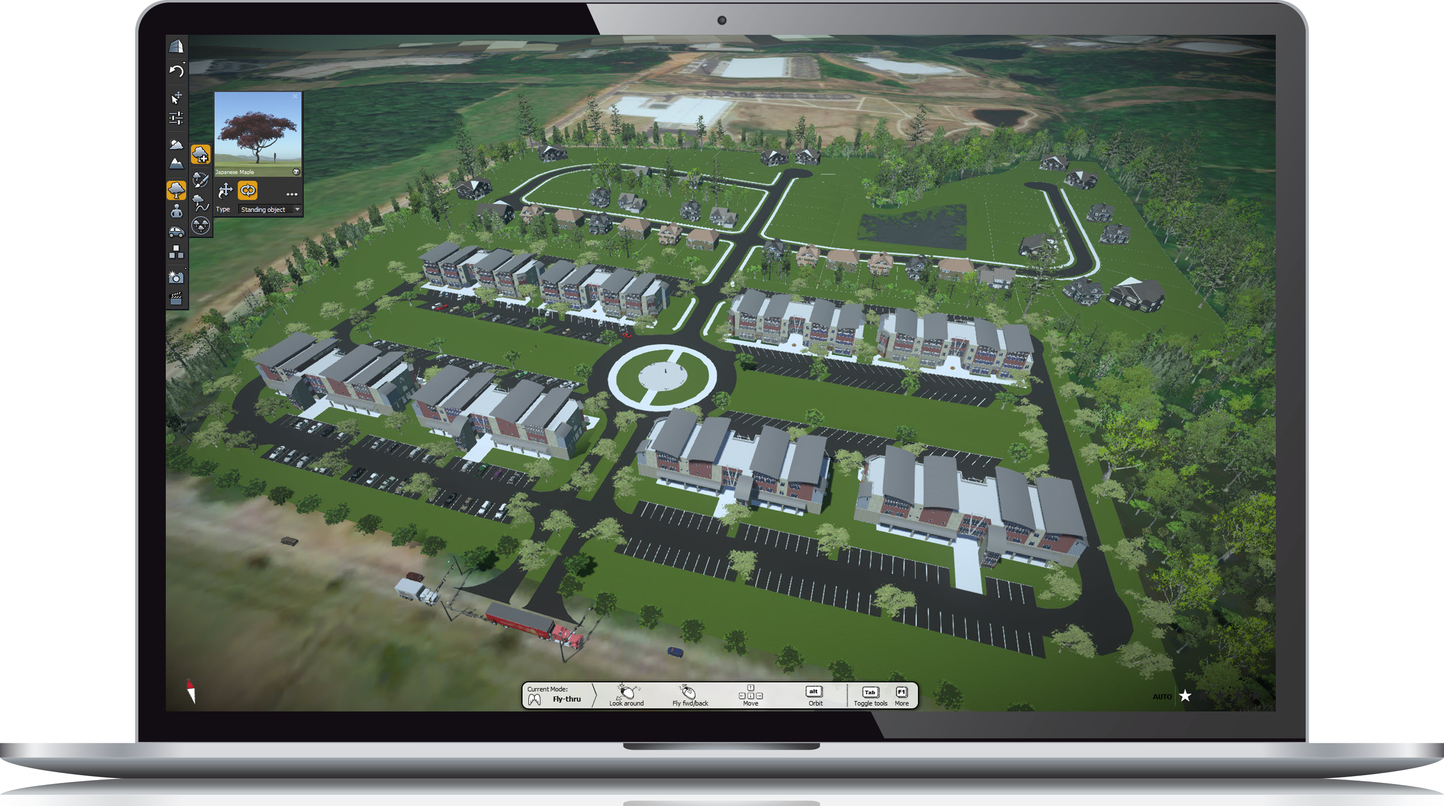
Civil WorkSuite for Site & Land Development Civil WorkSuite for Site & Land Development Improve your land development workflow Civil WorkSuite provides everything you need to streamline your land development workflow from data acquisition through construction documentation. Acquire Reality Modeling WorkSuiteCollect, consume, and share field dataCreate scalable 3D meshesDesign in a real-world contextIncrease precision and minimize survey rework Planning OpenSite Designer w/OpenSite SITEOPSDetermine project feasibility in hoursAutomated site layoutOne-click optimize earthwork gradingIdentify risk and create alternativesEliminate guesswork with a detailed budget Design OpenSite DesignerLumenRTComplete site engineering solutionCreate detailed engineering designsAutomated sheet and label creationEasy cross-discipline collaborationAccelerate stakeholder approvals with realistic visualizationsReduce design time by 20% with existing staff Analyze OpenSite DesignerOpenFlows CivilStormIntegrated utility design & analysis toolsPerform earthwork grading analysisGenerate design & analysis reportsAnalyze complex stormwater facilitiesVisualize designs to easily detect, prevent, and fix errors Deliver OpenSite DesignerOpenFlows CivilStormAutomate a variety of deliverablesDeliver detailed construction documentsAlways up-to-date data with dynamic change managementProduce realistic visualizations to convey design intentOutput files to other civil design platforms Explore Our Product Page For Some Great Videos, More User Examples, Technical Specifications, Flexible Licensing Options, And More. Shop Civil Worksuite Now Contact Us