

SEP 04, 2026
Beyond the Data Silo: How Connected Data and Digital Twins Unlock Infrastructure Value
Aude Camus, Senior Product Marketing Manager
Key Takeaways
- Connected data turns disconnected surveys, models, inspection records, and operational inputs into usable infrastructure intelligence.
- Earthbrain cut point-cloud tiling time from an estimated month to one hour by streaming only the site changes that matter.
- Haskoning improved inspection reporting efficiency by 1,080 hours and generated an estimated £150,000 ROI through a connected digital workflow.
- Collins Engineers and MnDOT used virtual bridge inspection training to improve hazard recognition and save 4,500 work hours.
- Connected digital twin workflows help infrastructure teams reduce rework, improve safety, and make faster decisions across the asset lifecycle.
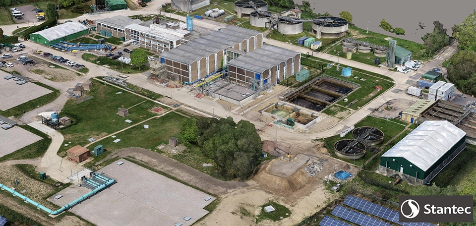
In today's infrastructure ecosystem, we are surrounded by an unprecedented volume of data. From high-density LiDAR scans and drone photogrammetry to complex BIM models, subsurface geotechnical surveys, and IoT sensor feeds, project teams capture terabytes of information every single day. Yet, many infrastructure owners and engineering firms find themselves in a challenging paradox: they are data-rich, but information-poor.
When critical spatial and engineering data remains trapped in disconnected software tools, local hard drives, or isolated data silos across teams, its true potential is lost. Missing drawings lead to field rework, outdated surveying delays design cycles, and unintegrated data sources force teams into manual, error-prone workarounds.
To solve these industry-wide bottlenecks, forward-thinking organizations are embracing a core strategic principle: unlocking the true value of their infrastructure by connecting survey, reality, engineering, and operational data. By establishing open, integrated digital twin environments, infrastructure leaders are connecting disparate data sources across the entire asset lifecycle—turning raw data into actionable insights, reducing risk, and accelerating delivery.
Connected data unlocks infrastructure value by making survey, reality, engineering, and operational information usable in one decision-ready environment.
Here is how three global innovators are leveraging connected data solutions to achieve remarkable efficiency gains and measurable ROI.
1. Streaming 100 GB of Earthworks Data in Real Time
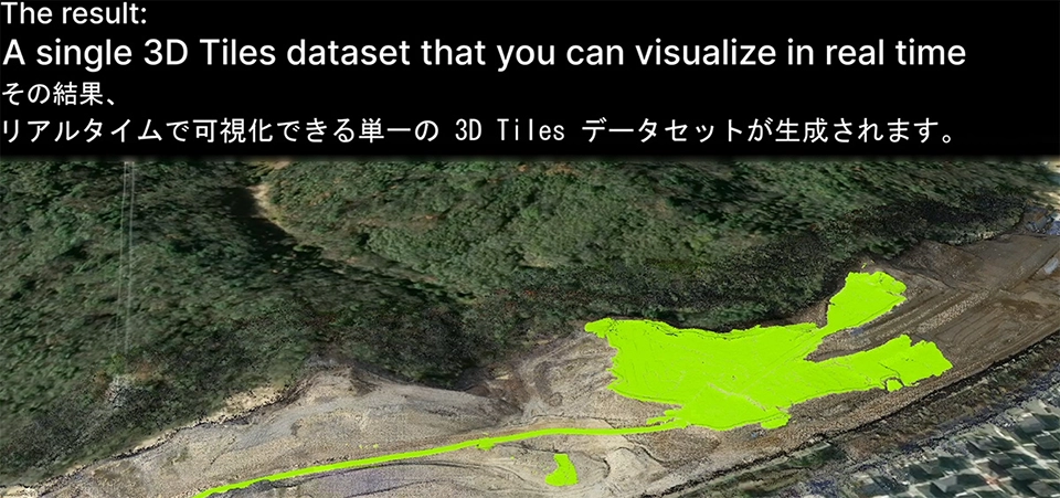
Earthbrain Ltd., headquartered in Tokyo, Japan, delivers a Smart Construction digital twin platform for the earthworks industry, serving thousands of users globally across massive infrastructure sites. However, managing daily drone photogrammetry and LiDAR point cloud data presented a massive technical bottleneck. Because displaying accumulated site data was incredibly slow, teams were forced to constantly re-tile entire site datasets to reflect new progress. To keep the system usable, they had to rely on frustrating workarounds like thinning out point cloud data or managing fragmented, separate files, which severely hindered real-time progress tracking.
To eliminate these bottlenecks, Earthbrain implemented an advanced 4D time-dynamic geospatial tiling solution capable of incremental streaming updates. Instead of wasting processing power re-tiling whole datasets, the engine processes and transmits only the changes that occur over time. This breakthrough enables dynamic temporal filtering and seamless comparison of site changes directly within a standard web browser.
The operational payoff was immediate and staggering. The new engine tiled 616 point cloud files—representing 100 GB of storage—in just 1 hour, a process that previously took an entire month (700 hours) using standard 3D tiles. This 700x speed improvement allows contractors to instantly compare today’s site progress with yesterday’s survey data, eliminating manual workarounds and preventing costly cut-and-fill rework before it happens.
2. Driving a £150,000 ROI at the UK's Busiest Port
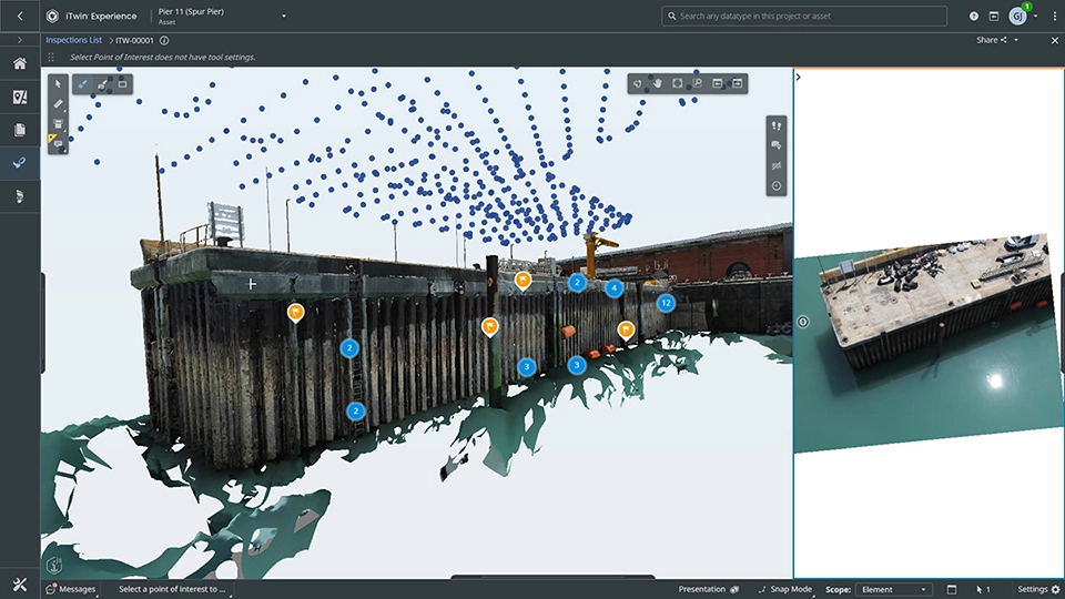
The multidisciplinary engineering firm Haskoning recently delivered the Dover Principal Inspections program for the Dover Harbour Board, covering 59 critical maritime and highway assets across the Port of Dover. Performing physical inspections in a live, high-traffic port is notoriously difficult. Teams not only had to manage tight tidal windows and vessel schedules, but they also faced heavy administrative overhead—constantly re-entering defect descriptions, photos, and recommendations across paper notes, isolated spreadsheets, CAD maps, and formal reports.
Haskoning solved this by establishing a connected digital inspection workflow, linking drone-derived 3D reality meshes directly to cloud-based inspection forms. This allowed engineers to virtually inspect assets within their exact 3D spatial context. Every observation was captured digitally on-site, generating 3,520 structured, spatially referenced defect records linked back to a single, cloud-based source of truth.
By standardizing data capture and automating report compilation, Haskoning cut total reporting time from 4,320 hours to 3,240 hours. This saved 1,080 hours of manual work across 88 deliverables, translating to an estimated £150,000 increase in ROI. Additionally, conducting virtual pre-inspections eliminated 60 person-hours of hazardous over-water physical exposure and saved four days of repeat site visits.
3. Virtualizing Bridge Safety Inspections for Minnesota's Highways
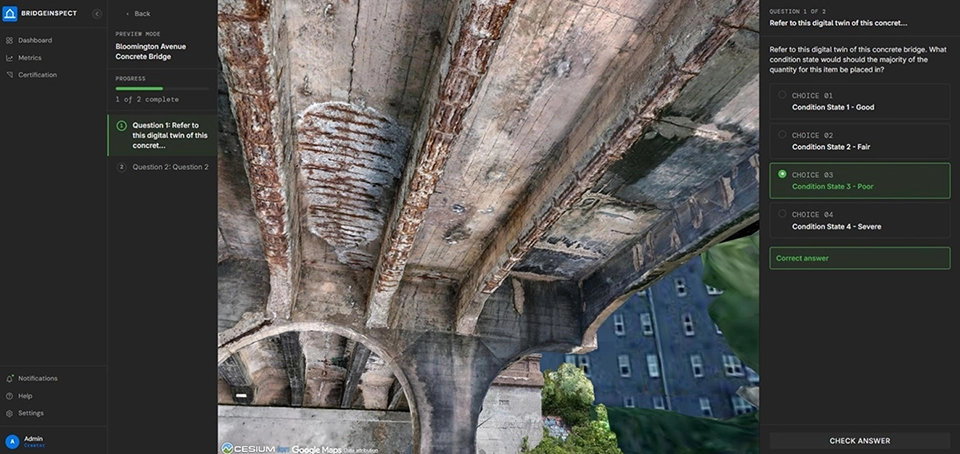
To modernize bridge safety inspection training for over 500 certified inspectors statewide, Collins Engineers partnered with the Minnesota Department of Transportation (MnDOT). Traditional inspector training relied heavily on static 2D drawings, photo libraries, and classroom instruction, which lacked crucial spatial context and failed to replicate real-world hazards. Furthermore, early-phase field training was logistically painful, requiring expensive work-zone setups, active lane closures, and significant safety risks involving heights, traffic, and confined spaces.
In response, the team built an immersive virtual bridge safety inspection training solution. By combining UAS reality models with digital inspection records from AssetWise and AI-powered crack detection, they created highly interactive, high-fidelity 3D virtual bridges. Inspectors can now navigate these virtual structures to identify structural defects and plan access constraints from the safety of an office before ever deploying to the field.
Now deployed to more than 500 certified inspectors, this digital-first training asset has dramatically improved hazard recognition while saving 4,500 work hours in field mobilization and travel. By reducing the need for live work-zone setups during initial training, the solution has lowered carbon emissions, enhanced worker safety, and established a repeatable, modern baseline for workforce training.
Unlocking Future Infrastructure Value with Connected Data
These three global case studies highlight a fundamental truth: data achieves its maximum value only when it is connected.
Whether it is unlocking a 700x speedup to drive daily operational decisions on earthworks sites, eliminating duplicate data entry to save over 1,000 hours during maritime inspections, or virtualizing safety training to better protect field crews, the impact is undeniable. By moving away from static files and closed software tools toward connected digital twin ecosystems, forward-thinking infrastructure leaders are actively reducing risk, protecting their assets, and delivering a more resilient built world.
Ready to unlock your own infrastructure value?
Discover how iTwin Capture helps teams connect reality data and turn it into actionable insights for faster, more confident decisions across the asset lifecycle.