

SEP 25, 2026
Can you dig it? The Archaeologist Teaching AI to Speak MicroStation
Louis-Martin Losier spent two decades capturing the ground, from Bronze Age Syria to Brazil's landslide country. At Bentley Systems, he’s raising the ceiling on MicroStation with AI that lets engineers simply tell the engineering software what they want.
By Sean O’Neill
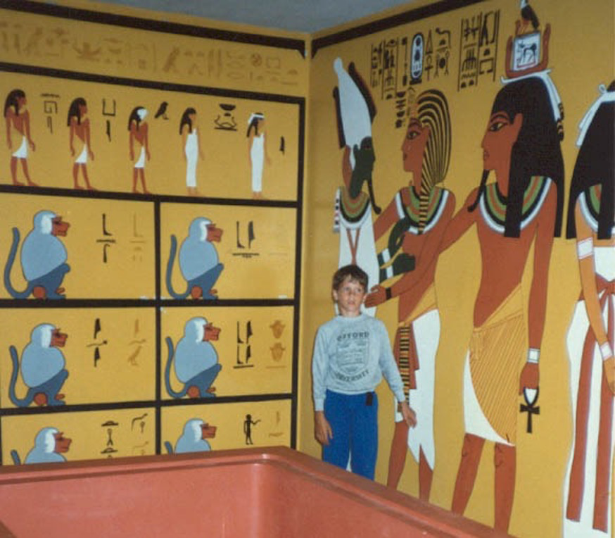 A young Louis-Martin, inspired by his visit to a replica of King Tutankhamun's tomb in 1986.
Key Takeaways
- An archaeologist's curiosity led Losier to reimagine engineering software.
- Making complexity accessible has defined his entire career.
- AI is transforming how engineers interact with software.
The arrow that found Louis-Martin Losier was lost hundreds if not a thousand years before he was born. He was 7 when he spotted the treasure, while wading beside his father in the Big Tracadie River in Canada’s New Brunswick province. His dad had followed the 1970s excavation of the First Nations settlement here on the river banks, and father and son had decided to see it in person. "Just walking in the water, we found an arrowhead," Losier says. "It made a big impact on me. Gave me an adrenaline rush."
If you had asked boys of Losier’s generation, many would say they dreamed of being an archaeologist, he says. Indiana Jones bore some responsibility, of course. Except Losier followed through.
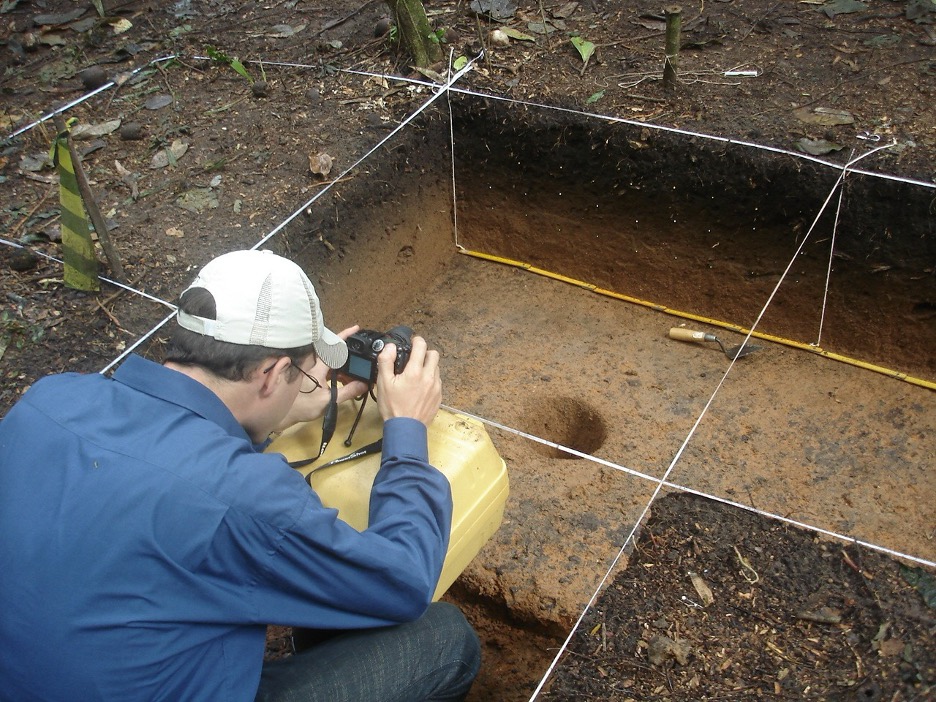 Assisting with excavation mapping at the Salobo Project, Serra dos Carajás, Pará, Brazil, preserving archaeological heritage in what would become the country's largest copper deposit.
As a teenager, he worked in Tracadie’s local museum, researching First Nations artifacts and recording tapes telling the story of each one. In a chance meeting some 15 years later, the museum's manager, Sister Zélica Daigle, told him that new staff still learned about the collection from Losier’s notes and tapes. The news was especially gratifying for a man who is driven to discover what experts know and put it within reach of other people.
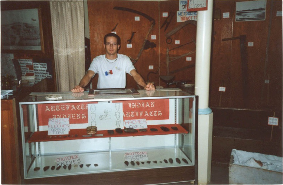 Losier researched artifacts and recorded their stories at the Tracadie-Sheila Museum. Years later, Losier’s notes and tapes were still being used to train new staff.
From Artifacts to AI
Today, he’s doing with artificial intelligence (AI) what he did with those artifacts: learning about the latest models and sharing his knowledge about their applications. He used AI agents together with AI to recreate both the Quebec Bridge, the world’s largest cantilever bridge often described as an engineering wonder of the world, and the 2,000-year-old Antikythera mechanism, which is considered the world’s oldest computer.
These AI applications are far from obvious within the infrastructure sector. After all, civil engineers must design bridges and power grids to highly specific measurements and standards; they cannot rely on AI-generated designs that are probably right. As a senior product manager at Bentley Systems, Losier is helping bridge that divide—the one between probabilistic large language models (LLMs) powering AI agents like Claude and Copilot, and deterministic engineering software like Bentley’s MicroStation, the software used to design and manage much of the world’s critical infrastructure.
For four decades, engineers have had to learn the language of MicroStation, mastering its unique commands, menus, and workflows. AI is beginning to level that learning curve. For the first time, engineers can express their intent in natural language, at the speed of thought, with the help of AI.
For Losier, this is the latest chapter in a lifelong fascination with discovery. Whether he is examining artifacts, mapping landscapes, assessing risk, or building AI-powered engineering tools, his goal has remained consistent: help people find meaning in complexity.
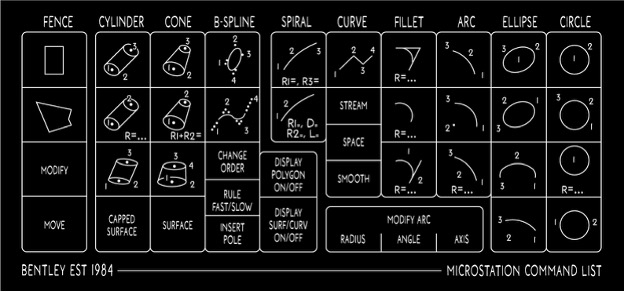 For four decades, engineers have had to learn the language of MicroStation, mastering its unique commands, menus, and workflows.
Show me the Bronze Age
In 1999, Losier moved a few hundred miles west of Tracadie, a region on the shores of the Gulf of St. Lawrence in far eastern Canada, to Laval University in Quebec City. While studying archaeology, he watched a master’s student use a combination of LiDAR and GIS (geographic information system) to model excavation sites, and Losier immediately saw new possibilities. He convinced the university to let him create a tailor-made degree in geomatics—a field that combines geography, measurement, and digital technology.
His master's subject was Tell ‘Acharneh, a large archeological site in western Syria where he expected to excavate. When the trip fell through, he decided to bring the site to him. He reconstructed it from existing field records using an oil-and-mining software designed to map rock strata called GOCAD.
At that time, most archaeological records existed as flat drawings of trench walls. Three-dimensional reconstructions were rare, and when they did exist, they were largely visualizations rather than analytical tools. In Losier's model of the site, each excavated layer became an object that a computer could measure, slice, and search by date or artifact. "You could put on a VR headset and navigate through the model, peel out the stratigraphic layers, and say, ‘Show me just the Bronze Age,’" he recalls. It wasn’t like the AI we know today, but the simulation was powerful. And it worked.
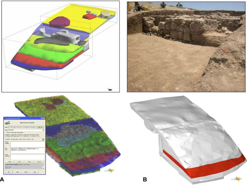 In one of Losier’s earliest research projects at Laval University, he applied 3D modeling and spatial analysis to reconstruct archaeological excavation units from high-precision GPS measurements. His digital models enabled archaeologists to explore, analyze, and better understand the past.
This Ph.D. is a bunch of garbage
Losier had another life-changing encounter at Laval. He met his future wife, Rosilei. She was an international graduate student from Brazil whose Ph.D. bursary came with a hefty catch: an obligatory four-year stay back home after her studies. Losier joined her on the trip, but when they touched down in Rio de Janeiro in 2006, Losier spoke no Portuguese and, because his diplomas weren’t yet recognized, no right to work in his field. So he turned to his digital modeling experience.
He started building websites for engineering departments at the Federal University of Rio de Janeiro (UFRJ), one of the country’s leading engineering schools. Upon learning about Losier’s geomatics work, a civil engineering professor suggested he work toward a doctorate that applied his Ph.D. to civil engineering. Losier quickly learned that archaeology had not prepared him for civil engineering. To bridge the gap, he taught himself the mathematics and physics he needed to beat strong competition and earn a place in the program.
His prize? The Adrianópolis landfill outside Rio. Authorities were steadily covering the mountain of garbage with soil in an innovative program that captured methane from the decomposing trash below to generate electricity. In fact, the landfill was the first project ever registered under the UN's carbon-credit scheme. But there were challenges. "The smell, with that heat, was terrible. Imagine it," Losier recalls. "And the scavenging urubu—big black vultures."
Heat, rain, and continuous decomposition also meant the landfill was constantly moving. The mountain’s terraced slopes could fail like any hillside, and methane and toxic leachate created additional risks.
Losier’s role was to monitor the conditions, and he built a web platform to stay on top of it. Data from boreholes and geophysics helped him map the ground beneath. Live sensors tracked volume displacement and embankment stability, measured the gasses, and monitored the lakes formed along the landfill. His simulation allowed him to bring all the information together into one dashboard and share it with the rest of the team. If a reading crossed a safety threshold, the model immediately alerted the managers.
The work was an early glimpse of a theme that would follow him throughout his career: bringing complex information together in an intuitive way so people can make better decisions.
The ground, in one view
When contractors in Brazil encountered engineering challenges beyond their in-house expertise, they would sometimes turn to researchers at UFRJ. In 2011, one such challenge arrived in the lab where Losier was working on his Ph.D. They needed to blast a tunnel beneath heritage-protected buildings in Salvador, a historic city in the north, but many of them were already showing cracks. The engineers were looking for a way to get the job done without making the damage worse.
Losier and his university colleagues approached the project as a digital canvas. They wired together more than 200 geotechnical instruments and some two dozen seismographs that monitored every detonation. "Bringing the geospatial context—georeferencing and all the geotechnical and geophysical sensors in one place, one view, in real time—that was a game changer in a web platform," he says. The tunnel went through without incident, but more importantly, the project proved there was a new way to manage complex infrastructure risk. Later that year, the concept became a startup co-founded by Losier, called Geovoxel, based at the university's technology park.
Geovoxel was quickly employed in dozens of projects across Brazil, supporting major infrastructure developments ranging from mining terminals to the mapping of underground assets for large urban projects. Among them were initiatives like the VLT tramway, which is the city’s light rail system, and the Bus Rapid Transit (BRT), both tied to Rio hosting the World Cup in 2014 and the Olympic Games two years later.
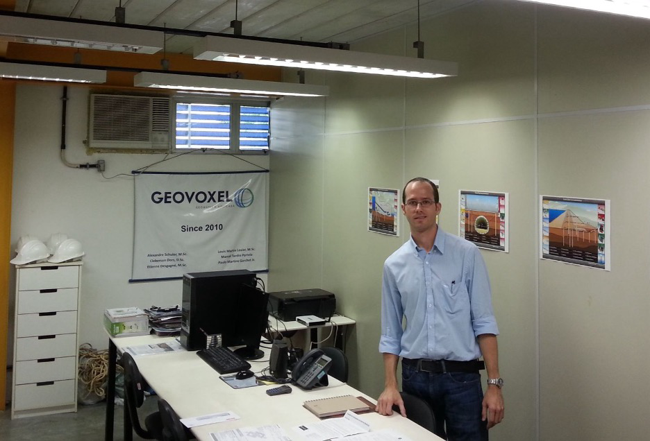 Geovoxel’s first office in 2011, in the startup incubator of the Technological park at the Universidade Federal do Rio de Janeiro.
A Watershed moment
While Rio built for the Olympic Games, the region’s hills kept coming down. In April 2010, heavy rains triggered devastating landslides at Grota Funda, in Rio’s western zone, blocking major highways and cutting off entire communities for days. During one storm, Losier’s wife drove home through what she called "a river in the road." The landslides left the family isolated for a week.
In January 2011, torrential rains triggered catastrophic floods and landslides in the mountainous region north of Rio de Janeiro, killing about 900 people in one of Brazil’s deadliest natural disasters. Angra dos Reis, a city just down the coast, had buried dozens of its own the year before.
Geovoxel transformed Angra's rainfall thresholds into a live map of landslide risk. Civil-defense teams carried the system into the field on portable devices, where they could watch conditions evolve in real time as storms rolled in. When risk levels crossed critical limits, the alerts turned red. That gave authorities precious time to mobilize, sound the sirens, and evacuate vulnerable areas. The system operated for about two years. "Every time it reached the limit, we were able to give the warnings in time to potentially save lives," Losier says.
The year everything broke
By 2015, Geovoxel had grown to gain national attention, including making the finals of the elevator pitch at the Google office for the BayBrazil contest and participating at TechCrunch Disrupt in San Francisco. “We thought we had a great future ahead of us," says Losier.
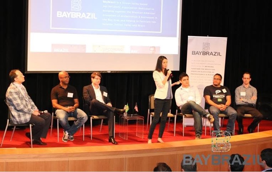 One of Geovoxel’s milestones was reaching the finals of the BAYBRAZIL elevator pitch competition at Google’s headquarters, where Losier presented to investors and technology leaders.
It wasn’t to be. Brazil's economic crisis was already creating uncertainty for many engineering firms, and Losier and his family were carefully thinking about their options. Then one event tipped the scale. Losier’s wife carpooled to work with a university colleague, meeting at the same spot each day. On a morning when their son had a fever, she arrived five minutes later than usual. "When she arrived," Losier recalls, "her colleague—who was never late—was not there." Hours later, they learned she had been abducted and robbed, then released physically unharmed. “I don't know what would have happened if my wife had also been there," he says.
The event made a big impact on the family and underlined questions they had already begun asking themselves: Where did they want to raise their son, and what kind of future did they want to create together?
Leaving took two more years, until his wife won a Brazilian bursary for a postdoc in Quebec. Geovoxel was split up. His partners kept the service business, and Losier carried the software to Quebec and started over at the LE CAMP tech incubator. Once there, he learned that 50 successful projects in another country didn’t seem to count for much, and he eventually made the difficult decision to close the company.
As Geovoxel wound down, a friend shared an opening for a product manager in the geospatial area at Bentley Systems. Losier remembered the software he had loved as a student at Laval: MicroStation. Four interviews later, in September 2018, he joined the company.
From geospatial into AI
His first Bentley years were spent bringing the planet into the software. He managed OpenCities Map, where utilities chart their pipes and cables against real streets, then Descartes, which turns laser scans into 3D models of real places. In 2022, he moved to the flagship, MicroStation, and brought the world with him. Live maps from Esri came first, then Google's photorealistic 3D tiles and Cesium's terrain, all inside the design software itself.
Losier also became one of Bentley's representatives to the wider geospatial world, from the Open Geospatial Consortium (OGC) standards body to a COP30 panel on resilient infrastructure.
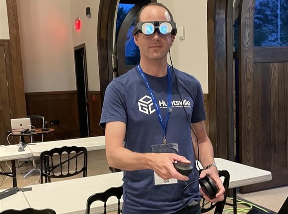 Behind blue eyes: Losier explores an immersive city digital twin at the OGC Technical Committee Meeting in Huntsville, Ontario, in 2023.
Then in 2024, Losier launched a major discovery effort with Bentley users. "We were not talking about AI at all, at first. We just wanted our users to tell us their most pressing problems, their biggest productivity challenges." Losier orchestrated workshops with key users, focusing on CAD or BIM managers, and drafters.
The first target was drudgery. Automation already existed but often required programming skills many users did not have. The result was the Python Assistant in MicroStation 2025, which allowed engineers and drafters to describe tasks in plain language and generate automation scripts without writing code themselves.
The next challenge was onboarding. New engineers often arrive with strong technical skills but little experience with Bentley software. The fix there was a second assistant, Bentley Copilot, which the company is now rolling out across its software. A newcomer briefs Copilot on their own skills, and it shows them how the workflows they already know are done in MicroStation. The assistant can also read a firm's own project manuals without the information ever leaving the firm's machines. Onboarding, Losier says, drops from days to a couple of hours.
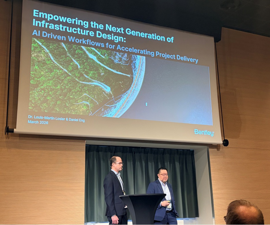 Losier with Bentley colleague Dan Eng on stage at AI in AEC 2026.
Say what you want
Today, Losier’s focus is helping engineers interact with software in a fundamentally different way. He leads a team of product managers that help users tap the full capability of MicroStation. This frontier is AI agents. An engineer connects the AI assistant they already use—Claude or GitHub Copilot, for example—to MicroStation through Bentley's new, experimental Model Context Protocol (MCP) server. The assistant can then operate the software on the user’s behalf. "It gives users the power to say what they want in natural language, and have the software execute it for them, without having to click through 20 buttons in a workflow," Losier says.
(Voice control will come too, he reckons, though Losier himself may be too Gen X to use it: friends send him voice notes; he answers by text.)
This year, Losier harnessed these new AI tools for his oldest passion. He had an AI agent use the MicroStation MCP server to recreate the Antikythera mechanism, the 2,000-year-old Greek astronomical computer, in less than a day of hands-on work. He also had an agent accurately recreate the geometry of the Quebec Bridge, the longest cantilever span on Earth, in a matter of days. Then he went a step further: a second MCP server, built for Bentley's structural-analysis software STAAD, let the agent run the finished geometry through a structural analysis.
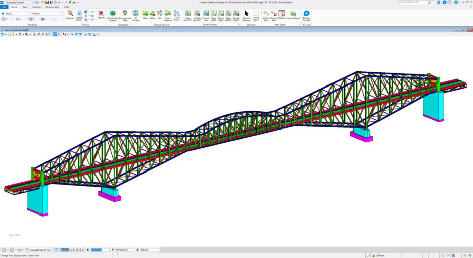 A 3D model of the historic Quebec Bridge, which crosses the St. Lawrence River west of the city.
Losier has his own yardstick. "It took me four months to build my Tell 'Acharneh model," he says. "With tools like these, I could have done it in a day or two."
Most boys grow out of their dreams. Losier just upgraded the tools.