Transform airports with connected data, streamlined workflows, and enhanced asset performance and efficiency. Integrate engineering, spatial, and enterprise data into a digital twin for stakeholders.
Connect physical and virtual worlds to better plan, design, construct, and operate digital estates.
Connect, Combine, and Manage Enterprise Data
Link, merge, and oversee data from various sources, formats, scales, or complexities—including point clouds, reality and BIM models, and operational data from business systems and IoT-connected devices. Offer real-time spatial insight for assets, developments, and projects, enabling digital workflows for different stakeholders.
Digitize Workflows
Visually immerse teams through a single, spatial view of operational assets, proposed developments, and active projects. Explore relationships between real-world objects, monitor progress on projects, minimize the time that personnel spend in dangerous or hostile locations through remote inspections, and/or optimize operational scenarios without impacting on the performance of in-service assets.
Gain Insight and Improve Decisions
Inspect, analyze, and report on multidiscipline data across the lifetime of assets. Save teams and stakeholders the time and effort finding and validating information, gaining the visibility and insight needed to improve their planning, design, delivery, and operational performance decisions.
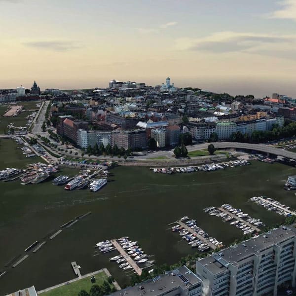
We are helping to create a better life for citizens using knowledge-based discussions and making decisions based on that data.
Jarmo Suomisto, Architect Project Manager, Helsinki 3D+, City Executive Office, City of Helsinki
Collaborate with asset and building owners, government agencies, developers, and members of the public. Efficiently plan and visualize at city or district scale; optimize transportation and pedestrian mobility; develop resilience strategies; manage public works projects; and support a better quality of life for citizens.
Digitally Advance Cities, Districts, and Regions
Unify and integrate data regardless of source, format, or complexity. Start with data that you already own, adding more as demand or capacity dictates—including geospatial data, reality models, and 2D and 3D CAD and BIM information, as well as big data from IoT-connected devices.
Collaborate with asset and building owners, government agencies, developers, and members of the public. Conduct global or local project overviews with teams and stakeholders—publishing to the web, mobile devices, or desktops to capture comments and feedback that inform decision-making.
Improve communication, engagement, and decisions for city planning, urban development, and city operations. Create and use smart dashboards and project portals; integrate live information from IoT-connected sensors, feeding data into 3D maps or project views; and view attributes and metadata within objects and components.
Surface and terrain models deliver a 3D reality mesh of the entire city. Coupled with their open data policy, Helsinki 3D+ is helping to create a better life for citizens with knowledge-based discussions.
Singapore Land Authority’s nation-scale digital twin incorporates over 25 terabytes of data covering the nation’s public roads, and with continuous updates advances urban planning, saving USD 13 million per year.
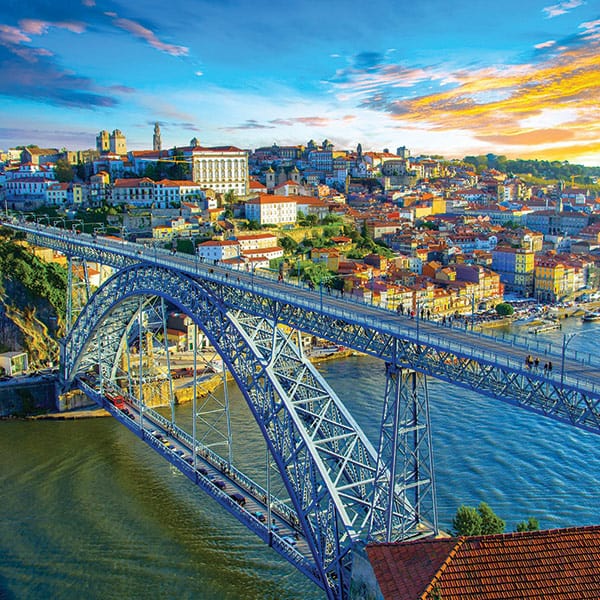
The city of Porto fosters innovation and collaboration. The city is a laboratory for testing and making a huge effort to be an example showing the private sector is the art of the possible.
“We are reimagining how interactive virtual environments and digital twins can support citizens to engage from the safety of their own home on new development projects in their local communities, setting a new standard for the future of planning and public engagement in cities.”
-Jamie Cudden, Smart City Program Manager – Dublin City Council
Collaborate with campus stakeholders, government agencies, developers, and the public. Efficiently plan and visualize at campus-scale; optimize crowd and transportation mobility; develop resilience strategies; manage civil works projects; and support a better on-campus experience.
Bridge Data Silos
Create a living digital twin from existing engineering, spatial, and enterprise data, including CAD, BIM, and reality models, geospatial information, and operational data from IoT-connected devices.
Create, visualize, and analyze different planning and operational scenarios through a 3D digital twin, increasing visibility and providing the insight needed to optimize decisions.
Reconsider traditional approaches to urban planning, use of space, and mobility, modeling and simulating the relationships between people, places, buildings, and devices.
FEATURED USER STORIES
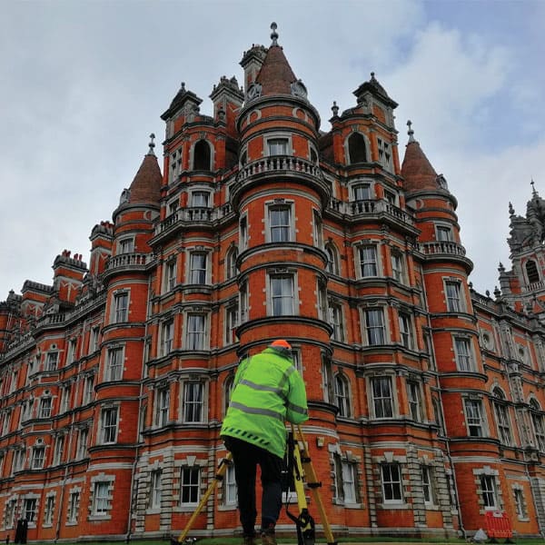
LANDSCOPE ENGINEERING
Royal Holloway Campus Digital Twin
The single view of above and below ground assets improves stakeholder collaboration, minimizes duplication, and reduces costs.
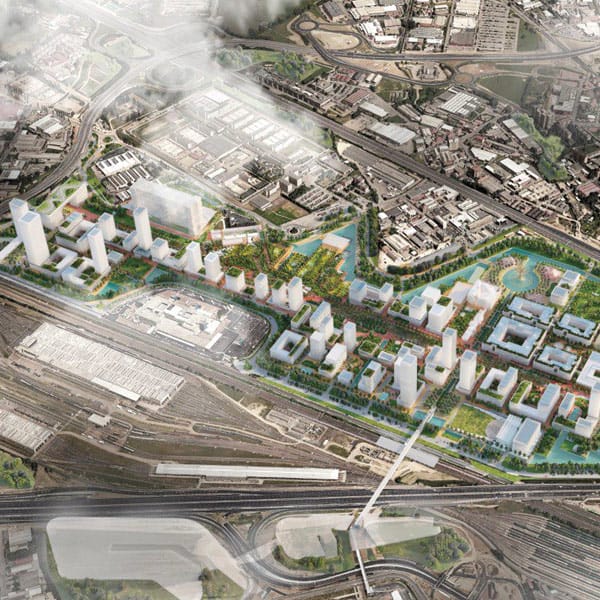
Systematica explored how an over 60,000-inhabitant, mixed-use campus can be effectively integrated with Milan’s transportation infrastructure with a more sustainable, multimodal approach.
A fully integrated virtual model allows facility managers to visualize accurate locations of work orders, increase response time, and improve performance for more efficient asset maintenance and campus management.
“Siemensstadt 2.0, hasn’t been started in the pandemic. It started long before with the plan to conserve the area where Siemens was born, where we have huge and traditional buildings, factories, research and development locations, and headquarters to open it up for the city and also for partners. So, it’s like a campus, and it’s the first time a campus project of that size is in one digital thread along the whole lifecycle of design, construction, and maintenance.”
Enabling the Airports and Ports of Tomorrow with Digital Twins
Work smarter to optimize safety, sustainability, and the resilience of assets and related services to overcome the many challenges, including changing demand, different operating conditions, and higher costs. Get the visibility and insight that every stakeholder needs to make the airports and ports of tomorrow more sustainable, cost-effective, and accessible.
Digitize Workflows
Connect, combine, and manage enterprise data and systems regardless of source, format, scale, or complexity—including 2D drawings, BIM and GIS information, reality models, and big data, enabling digital workflows to increase access, build trust, and maximize value.
Gain Insight
Visually immerse teams through a single, in-context view of operational assets, proposed developments, and active projects—leveraging intuitive web-based tools, game-like navigation, and persona-based views, to streamline collaboration and communication.
Improve Decisions
Inspect, analyze, and report on multidiscipline data across the asset lifecycle of your facility, enabling users to save time and effort finding and validating information they can trust and—with the insight gained—improve the decisions that enable better business outcomes.
FEATURED USER STORIES
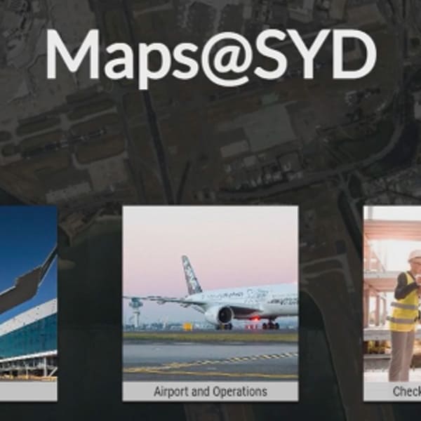
SYDNEY AIRPORT
Map@SYD
Sydney Airport has started its journey toward the development of their digital twin through Maps@SYD, which is helping to increase efficiency, improve quality, and reduce costs.
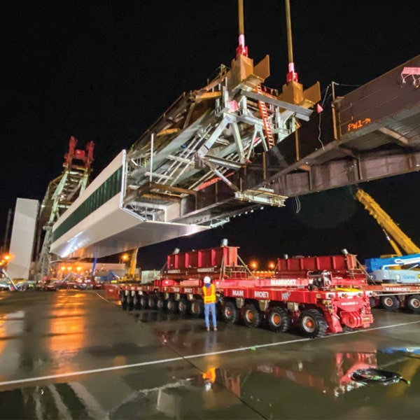
Clark Construction created a digital twin of construction sequencing, helping to optimize the installation of the world’s longest pedestrian walkway over an active airport taxiway.
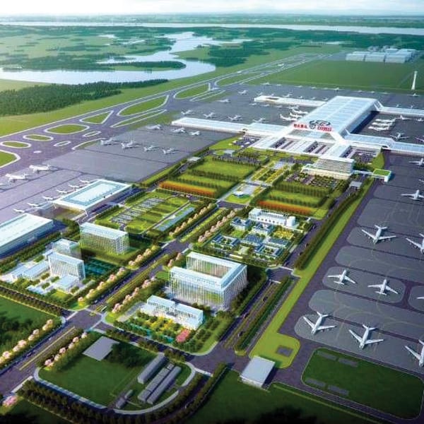
Establishing a digital twin to support multisourced 3D models, attributes, and documents helped the team at Hubei International Logistics Airport resolve 6,000 issues, reducing costs by CNY 200 million and shortening model delivery by 90 days.
“Bentley’s SYNCHRO 4D, in conjunction with industry expert knowledge and leading construction technologies, helped us digitally plan the successful remote assembly, transport, and install of the world’s longest pedestrian walkway over an active airport taxi lane.”
– Brian Krause. Vice President – Clark Construction Group, LLC
Reimagine Cities with Digital Twins
Collaborate with asset and building owners, government agencies, developers, and members of the public. Efficiently plan and visualize at city or district scale; optimize transportation and pedestrian mobility; develop resilience strategies; manage public works projects; and support a better quality of life for citizens.
Digitally Advance Cities, Districts, and Regions
Unify and integrate data regardless of source, format, or complexity. Start with data that you already own, adding more as demand or capacity dictates—including geospatial data, reality models, and 2D and 3D CAD and BIM information, as well as big data from IoT-connected devices.
Collaborate with asset and building owners, government agencies, developers, and members of the public. Conduct global or local project overviews with teams and stakeholders—publishing to the web, mobile devices, or desktops to capture comments and feedback that inform decision-making.
Improve communication, engagement, and decisions for city planning, urban development, and city operations. Create and use smart dashboards and project portals; integrate live information from IoT-connected sensors, feeding data into 3D maps or project views; and view attributes and metadata within objects and components.
Surface and terrain models deliver a 3D reality mesh of the entire city. Coupled with their open data policy, Helsinki 3D+ is helping to create a better life for citizens with knowledge-based discussions.
Singapore Land Authority’s nation-scale digital twin incorporates over 25 terabytes of data covering the nation’s public roads, and with continuous updates advances urban planning, saving USD 13 million per year.
The city of Porto fosters innovation and collaboration. The city is a laboratory for testing and making a huge effort to be an example showing the private sector is the art of the possible.
“We are reimagining how interactive virtual environments and digital twins can support citizens to engage from the safety of their own home on new development projects in their local communities, setting a new standard for the future of planning and public engagement in cities.”
-Jamie Cudden, Smart City Program Manager – Dublin City Council
Digitize Corporate and Educational Campuses
Collaborate with campus stakeholders, government agencies, developers, and the public. Efficiently plan and visualize at campus-scale; optimize crowd and transportation mobility; develop resilience strategies; manage civil works projects; and support a better on-campus experience.
Bridge Data Silos
Create a living digital twin from existing engineering, spatial, and enterprise data, including CAD, BIM, and reality models, geospatial information, and operational data from IoT-connected devices.
Create, visualize, and analyze different planning and operational scenarios through a 3D digital twin, increasing visibility and providing the insight needed to optimize decisions.
Reconsider traditional approaches to urban planning, use of space, and mobility, modeling and simulating the relationships between people, places, buildings, and devices.
FEATURED USER STORIES
LANDSCOPE ENGINEERING
Royal Holloway Campus Digital Twin
The single view of above and below ground assets improves stakeholder collaboration, minimizes duplication, and reduces costs.
Systematica explored how an over 60,000-inhabitant, mixed-use campus can be effectively integrated with Milan’s transportation infrastructure with a more sustainable, multimodal approach.
A fully integrated virtual model allows facility managers to visualize accurate locations of work orders, increase response time, and improve performance for more efficient asset maintenance and campus management.
“Siemensstadt 2.0, hasn’t been started in the pandemic. It started long before with the plan to conserve the area where Siemens was born, where we have huge and traditional buildings, factories, research and development locations, and headquarters to open it up for the city and also for partners. So, it’s like a campus, and it’s the first time a campus project of that size is in one digital thread along the whole lifecycle of design, construction, and maintenance.”
Enabling the Airports and Ports of Tomorrow with Digital Twins
Work smarter to optimize safety, sustainability, and the resilience of assets and related services to overcome the many challenges, including changing demand, different operating conditions, and higher costs. Get the visibility and insight that every stakeholder needs to make the airports and ports of tomorrow more sustainable, cost-effective, and accessible.
Digitize Workflows
Connect, combine, and manage enterprise data and systems regardless of source, format, scale, or complexity—including 2D drawings, BIM and GIS information, reality models, and big data, enabling digital workflows to increase access, build trust, and maximize value.
Gain Insight
Visually immerse teams through a single, in-context view of operational assets, proposed developments, and active projects—leveraging intuitive web-based tools, game-like navigation, and persona-based views, to streamline collaboration and communication.
Improve Decisions
Inspect, analyze, and report on multidiscipline data across the asset lifecycle of your facility, enabling users to save time and effort finding and validating information they can trust and—with the insight gained—improve the decisions that enable better business outcomes.
FEATURED USER STORIES
SYDNEY AIRPORT
Map@SYD
Sydney Airport has started its journey toward the development of their digital twin through Maps@SYD, which is helping to increase efficiency, improve quality, and reduce costs.
Clark Construction created a digital twin of construction sequencing, helping to optimize the installation of the world’s longest pedestrian walkway over an active airport taxiway.
Establishing a digital twin to support multisourced 3D models, attributes, and documents helped the team at Hubei International Logistics Airport resolve 6,000 issues, reducing costs by CNY 200 million and shortening model delivery by 90 days.
“Bentley’s SYNCHRO 4D, in conjunction with industry expert knowledge and leading construction technologies, helped us digitally plan the successful remote assembly, transport, and install of the world’s longest pedestrian walkway over an active airport taxi lane.”
– Brian Krause. Vice President – Clark Construction Group, LLC